Oukaïmeden’s Hill Dam: A Water Reservoir in the Heart of the High Atlas
Oukaïmeden’s Hill Dam: A Water Reservoir in the Heart of the High Atlas

Ourika Press – Ourika Tourist Guide
High in the High Atlas Mountains, at a considerable altitude in the province of Al Haouz, Oukaïmeden is often associated with snow, dramatic mountain landscapes and high-altitude pastures. Yet behind this natural scenery are also water-management structures that have played a role for decades in retaining water and shaping the surrounding landscape.
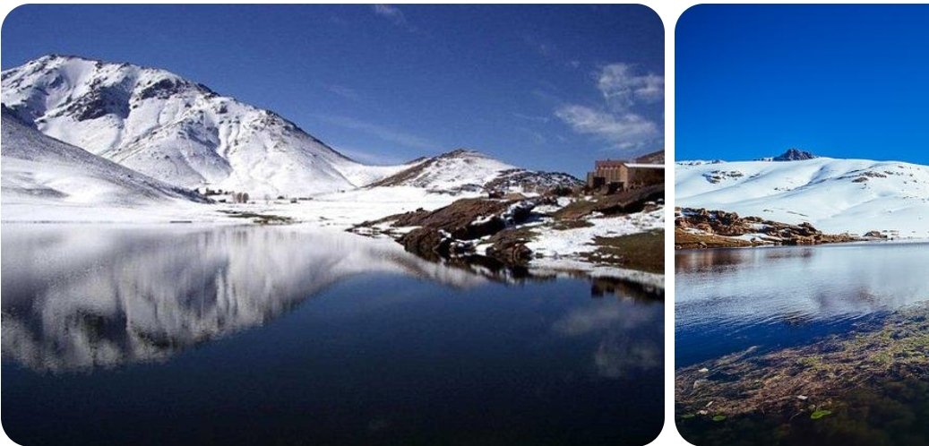
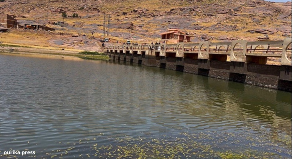
Among them is the Oukaïmeden hill dam, a small water reservoir located near the resort and now forming part of the distinctive mountain landscape of the area.
During a field visit to Oukaïmeden, Ourika Press captured exclusive photographs of the structure and its surroundings, as well as a field video offering a closer look at this remarkable setting where water, mountains, pastoral life and nature come together.
A Small Reservoir Surrounded by the Atlas Mountains
The dam is located around the Oukaïmeden plateau, within the upper part of the Ourika watershed, where rocky terrain, mountain pastures and seasonal watercourses meet.
Scientific studies confirm the presence of a dam on the Oukaïmeden plateau since the 1970s. Research focusing on the area’s wetlands has also indicated that its construction contributed to the expansion of nearby wet areas by allowing water to remain in the landscape for longer periods.
The structure should therefore not be viewed simply as an isolated reservoir in the mountains, but rather as an element that has become integrated into the surrounding natural environment.
From Rain and Snow to the Water Cycle
Oukaïmeden experiences a harsh mountain climate, with significant snowfall during winter as well as rainfall whose amounts vary considerably from one year to another.
Snow plays a particularly important role in the water cycle at high elevations. It can remain on the upper slopes for several months before gradually melting as temperatures rise and spring arrives.
Scientific research on the region indicates that snow cover on parts of the Oukaïmeden plateau can persist from November until late April or early May. Its gradual melting contributes to the flow of streams and the replenishment of wetlands in the surrounding mountain environment.
The water reaching Oukaïmeden therefore comes through more than one pathway: rainfall and snowfall together form part of a hydrological cycle closely linked to altitude, terrain and climate.
A Landscape That Changes With the Seasons
Visitors discovering Oukaïmeden in summer may see a water reservoir surrounded by rocks and mountain pastures. Yet the same landscape changes dramatically during winter.
As snowfall covers the surrounding mountains, the area can turn into a vast white landscape, with parts of the terrain temporarily disappearing beneath the snow.
When the cold season ends, the gradual melting of the snow returns water to streams, natural depressions and wetlands.
This seasonal transformation gives the dam and its surroundings a completely different appearance depending on the time of year.
Water and Mountain Pastoralism
It is difficult to speak about Oukaïmeden without mentioning mountain pastoralism.
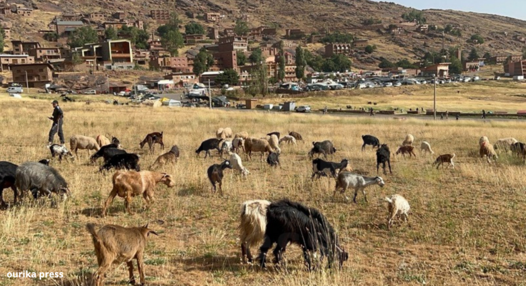
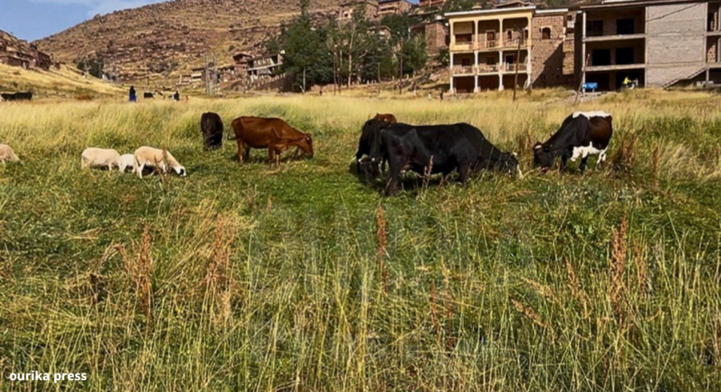
The area is known for its high-altitude pastures, which receive livestock herds during the pastoral season. This activity has been part of the relationship between local communities and the mountain environment for generations.
Sources focusing on Oukaïmeden highlight the importance of its high-altitude grazing areas and the seasonal movement of livestock associated with communities in the Ourika and Rheraya valleys.
In such a mountainous environment, access to water is naturally essential for people, animals and vegetation.
This gives small water-management structures a particular importance, even when they are far smaller than Morocco’s major dams.
Part of a Larger Natural System
Studies of the Oukaïmeden plateau show that its wetlands and mountain pastures are closely connected to the presence and movement of water through soils, streams and natural depressions.
The construction of the dam in the 1970s also contributed to changes in the distribution of some wetlands around the structure.
Its influence therefore extends beyond the amount of water it can retain. It is also part of the interaction between water, soil, vegetation, livestock and local communities in a fragile mountain environment.
Another Side of Oukaïmeden Beyond the Snow
Oukaïmeden is often associated with snow and winter tourism.
But the region has many other fascinating features: mountain pastures, wetlands, streams, rocky landscapes and, above all, an ancient human heritage that has made Oukaïmeden an important site for rock art in Morocco.
Visiting the region in summer therefore offers an opportunity to discover another Oukaïmeden, very different from the snowy landscape familiar to winter visitors.
From the Dam to a Story Older Than Water
Perhaps this is one of the most fascinating aspects of the site.
The story of the dam does not end with water.
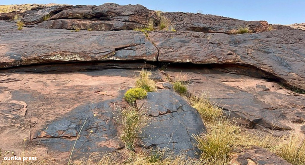
Near this structure are rocks bearing traces, drawings and engravings left by humans in ancient times, providing evidence of human presence in these mountains thousands of years ago.
And this is where another chapter of Oukaïmeden begins — a story told not by water, but by stone.
In the next episode of the “Ourika Tourist Guide”, we will leave the reservoir behind and move closer to one of Oukaïmeden’s most fascinating heritage treasures: the rock engravings that make the area an important site for the study of rock art in the High Atlas and Morocco.
If the dam preserves water, the rocks preserve memory.
Photos and video: Ourika Press